Skip to content
Ekşi Höyük.
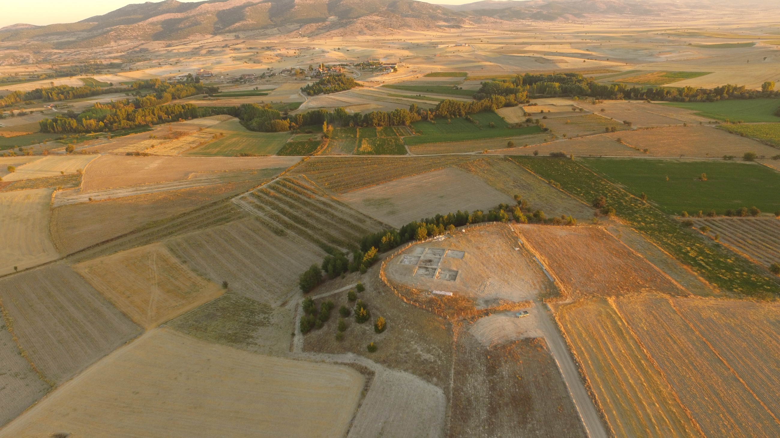
Aerial view of Ekşi Höyük at golden hour: a low mound surrounded by fields, with the Baklan Plain and mountains beyond.

Denizli · Baklan Plain · Neolithic – Chalcolithic

Ekşi Höyük

A Neolithic mound on the Baklan Plain, holding the memory of villages built one upon another since the 7th millennium BC.

Excavated since 2015 11 seasons Director Prof. Dr. Fulya Dedeoğlu Konakçı

One mound. Nearly nine thousand years. Each village covered the one before it, and the earth rose layer upon layer.

01

About the Mound

In the village of Dayılar, in the Çal district of Denizli, at a strategic threshold where the basin floor of the Çivril and Baklan plains meets the natural route up to the Çal Plateau, rises a natural hill formed in the Neogene epoch. What turned it into a mound was not nature but people: the accumulation of villages built one upon another over thousands of years.

Ekşi Höyük illuminates the Neolithic period of the Upper Meander Basin. Systematic surveys by Eşref Abay and Fulya Dedeoğlu Konakçı across the plains and highlands identified 18 settlements dated to the 7th–6th millennia BC; excavations began in 2015 at Ekşi Höyük, the best preserved among them.

The evidence shows that the first village was founded in the first quarter of the 7th millennium BC. Its earliest phase is defined by red lime-plastered rectangular buildings dated to 6750–6600 BC, followed by apsidal buildings between 6400 and 6000 BC. Occupation continued, intermittently, until around 5500 BC; much later, in the 10th–11th century AD, the mound was reused as a cemetery. Seven distinct building levels have been documented so far.

The excavation seeks not merely to open a single layer, but to understand the Neolithisation of the basin — how the founding communities organised themselves, their subsistence strategies and their use of space. Work continues under Prof. Dr. Fulya Dedeoğlu Konakçı, with the permission of the Turkish Ministry of Culture and Tourism and the support of Ege University.

8,700+
Years since the first village · c. 6750 BC
7
Superimposed building levels
~1,250
Years of continuous Neolithic occupation · 6750–5500 BC
11
Excavation seasons · since 2015

The Face of the Mound

A gaze from eight thousand years ago.

A clay head of a few centimetres still carries the trace of the hands that shaped it: a pressed-in eye socket, a brow marked with a single line, ochre smeared with a fingertip. The figurines of Ekşi Höyük are the early village community's most direct testimony about itself.

A clay human-head figurine against a dark background; modelled eyes and traces of red ochre on its surface.
Ochre-painted clay figurine head · Ekşi Höyük Excavation Archive
02

Settlement Chronology

  1. c. 6750 – 6600 BC

    Foundation: the first village

    The settlement's earliest phase is defined by red lime-plastered rectangular buildings. The first farming community of the Baklan Plain establishes the core of the mound.

  2. 6400 – 6000 BC

    The apsidal-building era

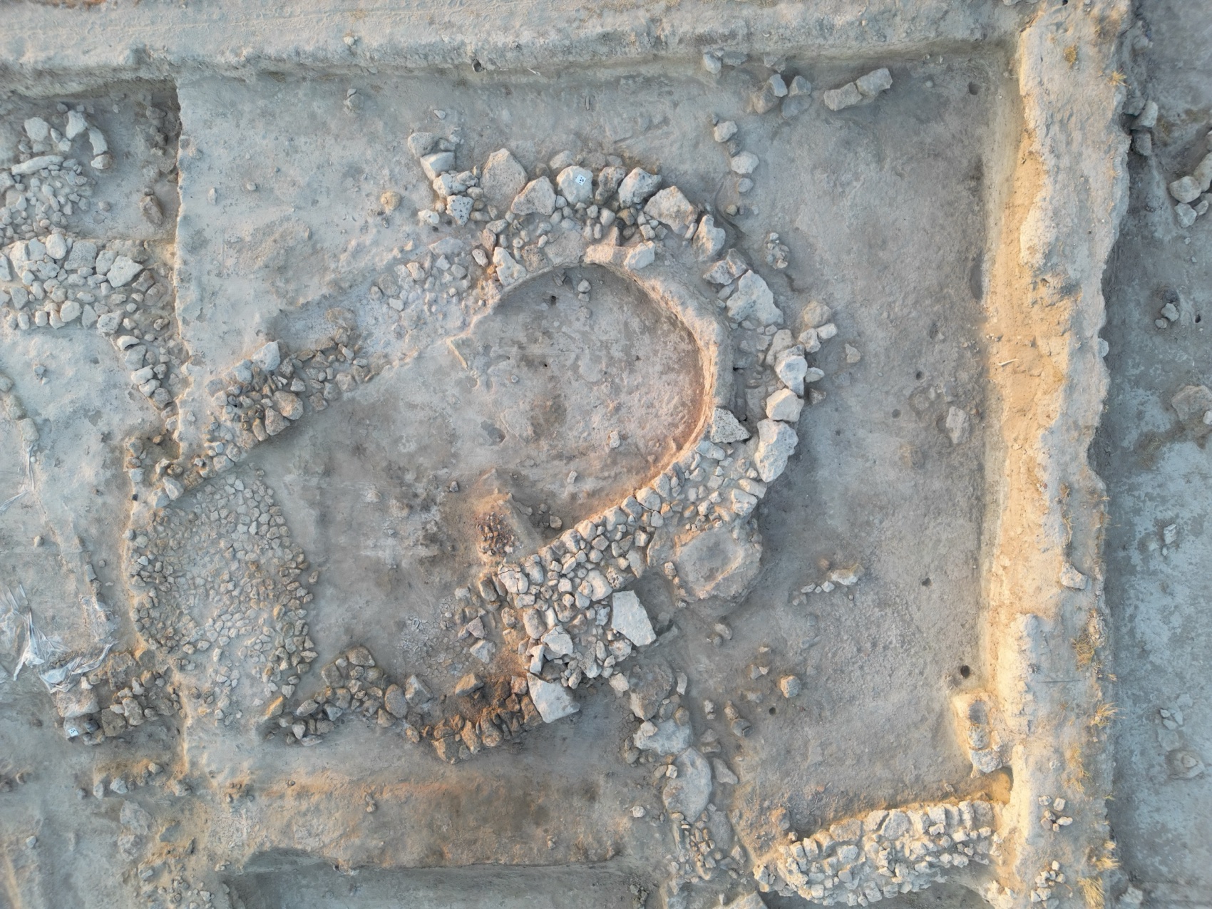
    Horseshoe-plan (apsidal) houses rise, some with ovens inside. The first phase of one apsidal house ended in fire and was carefully sealed — the rhythm of life pressed into the layers.

  3. until c. 5500 BC

    From Late Neolithic to Chalcolithic

    Although modern agriculture has eroded the upper layers, the evidence indicates that occupation continued, intermittently, into the Chalcolithic Age.

  4. 10th – 11th century AD

    The hill becomes a cemetery

    Thousands of years later, the abandoned mound is reused in the medieval period as a burial ground.

  5. 2015 – today

    Excavation begins

    Following the surveys, the Ekşi Höyük Archaeological Excavation Project (EKAP) begins. Seven building levels have been documented over eleven seasons; work continues.

Overhead view: the stone walls of a horseshoe-plan apsidal building stand out in the raking light of sunset.
Apsidal building in sunset light6400–6000 BC phase · excavation archive
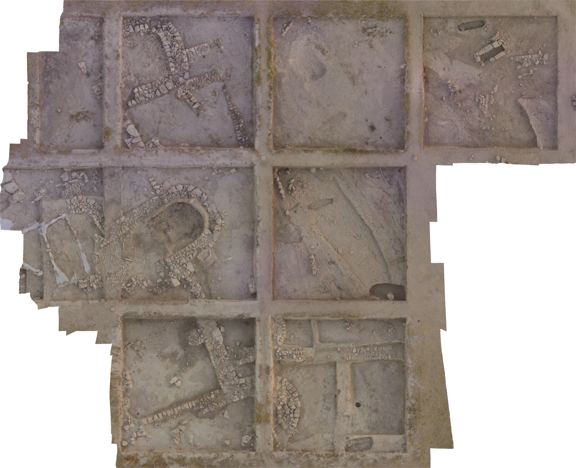
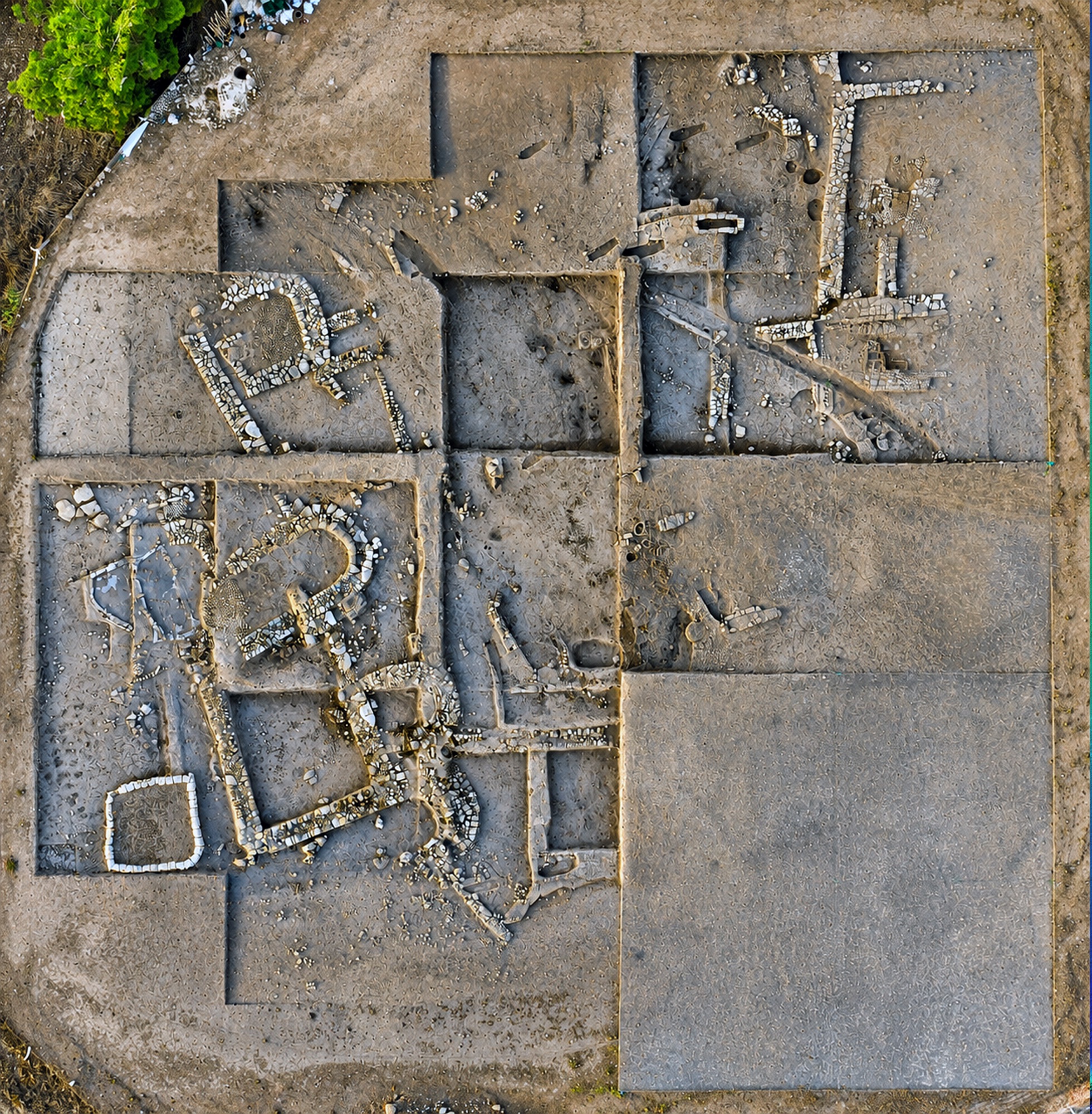
Overhead natural-colour orthophoto of the excavation area: trenches divided into grid squares, stone walls, and the apsidal building at centre.
Overhead plan of the excavationOrthophoto · drone photogrammetry · 2021

The Archaeology of the Millimetre

Each season, the mound is mapped millimetre by millimetre.

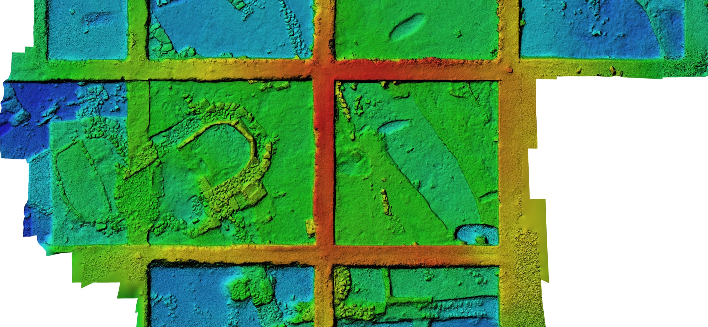
Every season, hundreds of drone frames are combined through photogrammetry into a centimetre-resolution digital elevation model of the mound. In the model below, colour encodes height — red is high, blue is low; the baulks and the hollow of the apsidal building can be read at a glance. As the soil is lifted — irreversibly changing the past — the memory of the dig is preserved in these records.

Colour digital elevation model of the Ekşi Höyük trenches: baulks as a red grid, the hollow of the apsidal building and floors in blue-green tones.
Digital Elevation Model (DEM)Colour = height · drone photogrammetry · 2021
03

Finds

A clay figurine face against a dark background: a modelled nose and eyes marked with incised lines.
Clay figurine headFired clay

The daily life the soil kept

The excavations yield clay figurines, chipped-stone tools, sling bullets, bone tools and early pottery. In building levels 6 and 7, the densest find groups are animal bone and chipped stone; some areas point to bone-tool production, others to chipped-stone workshops. Every find is recorded with its drawing, photograph and stratigraphic context, so that the object is never severed from where it was found.

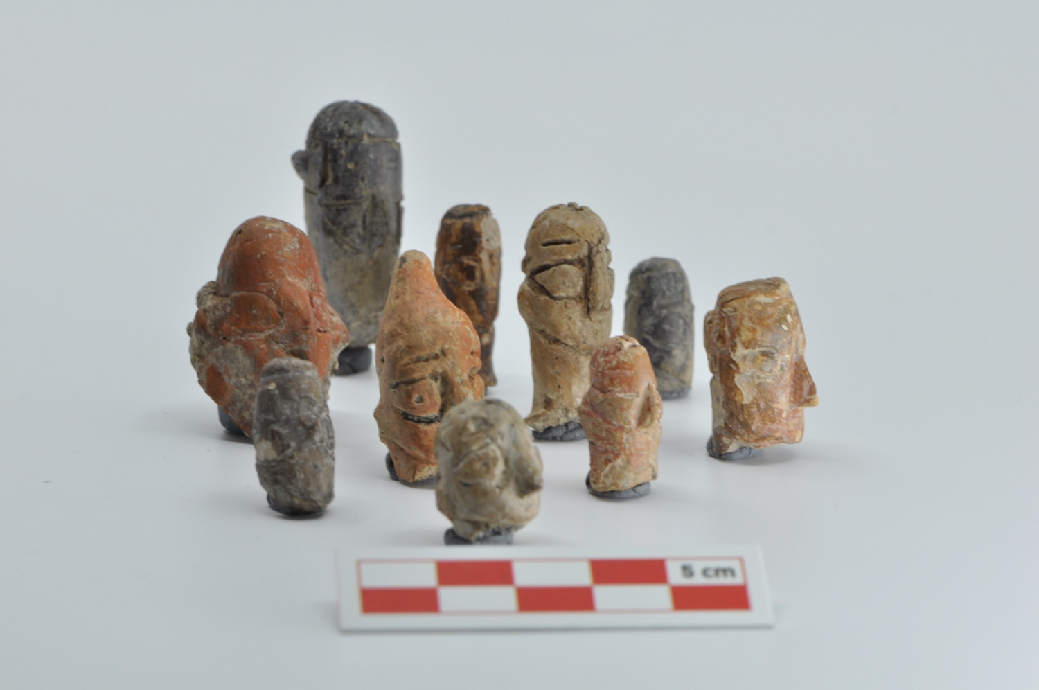
About ten small clay figurines together against a grey background, with a 5-centimetre scale in front.
A group of clay figurinesFired clay · excavation archive
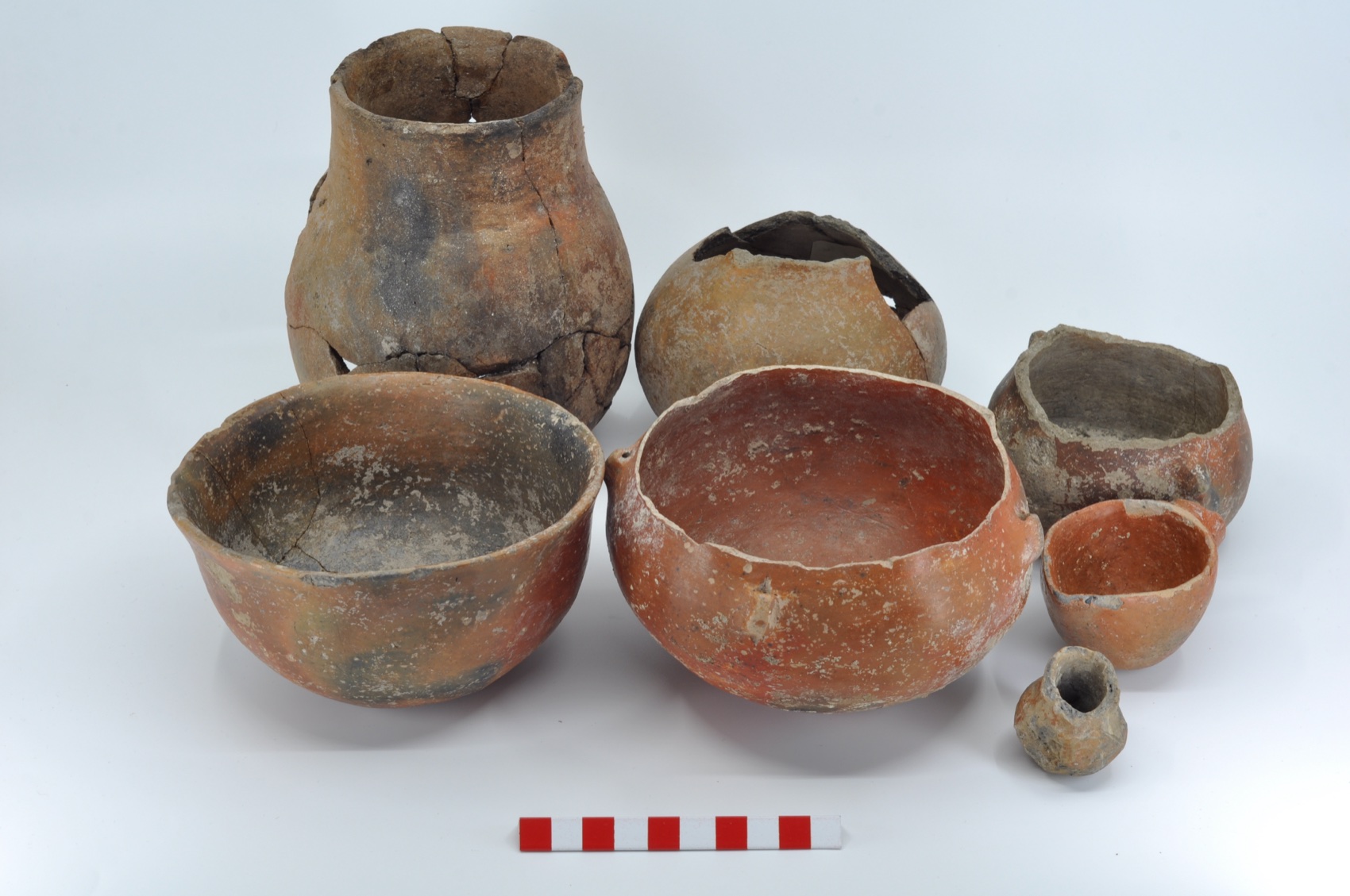
Seven early-period ceramic vessels against a grey background: jars and deep bowls, with a scale in front.
Early-period potteryFired clay
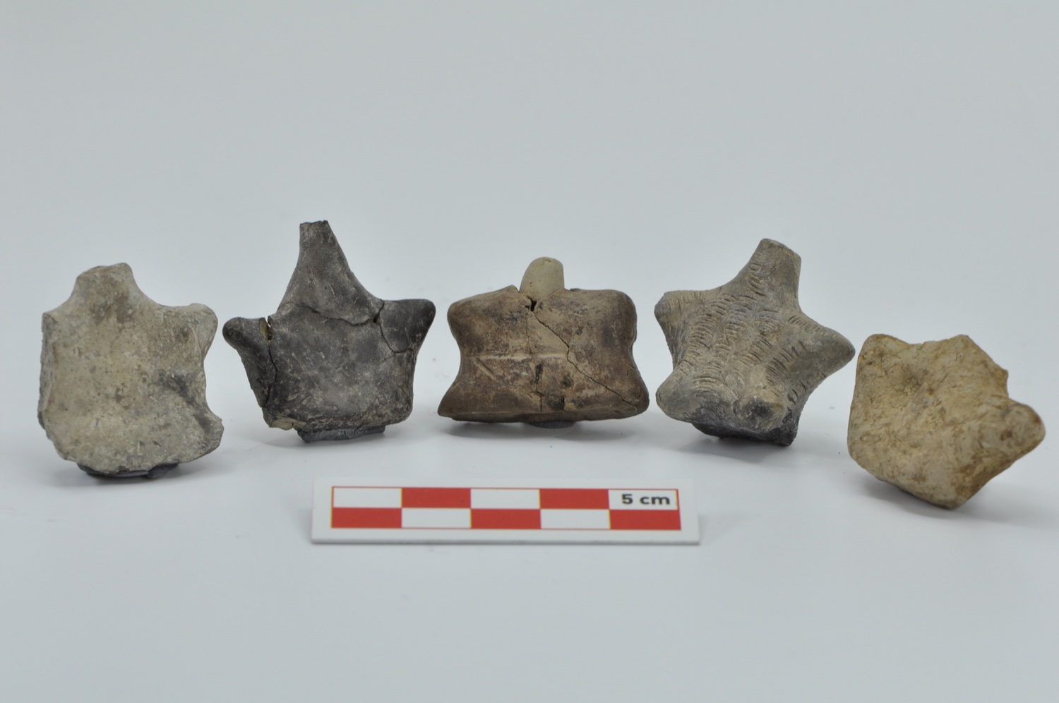
Five small clay objects against a grey background; impressed and incised decoration on their surfaces, with a scale in front.
Decorated clay objectsFired clay
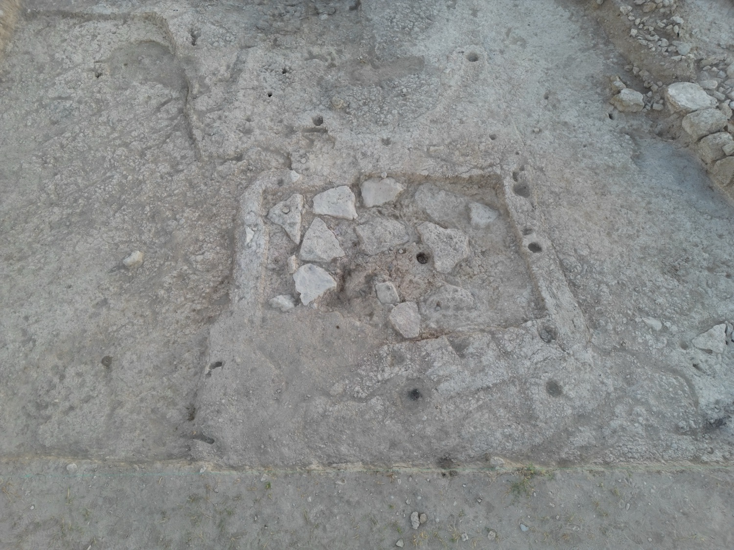
A stone-paved rectangular floor exposed in an excavation trench.
Stone-paved floorIn the field · in situ
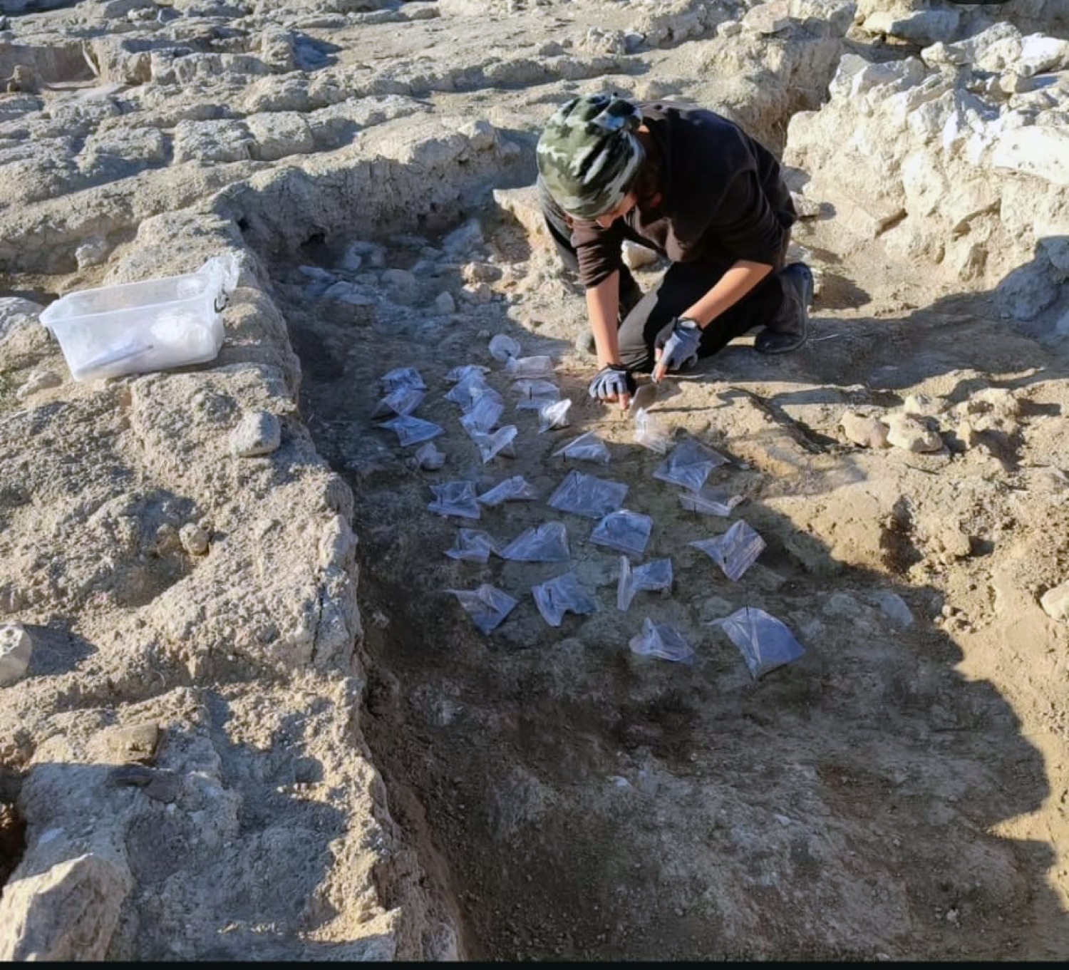
A team member working over labelled bags of finds laid out in a trench.
Finds documented in placeIn the field · in situ
Overhead orthophoto of the excavation area: wall remains within trenches divided into grid squares.
Orthophoto of the excavation areaPhotogrammetry · excavation archive
04

Team

Excavation Director

Prof. Dr. Fulya Dedeoğlu Konakçı

Ege University · Department of Archaeology

Has directed the Ekşi Höyük Archaeological Excavation Project (EKAP) since 2015.

Deputy Directors

  • Asst. Prof. Bora Temürİzmir Democracy University
  • Res. Asst. Doğa YeşilbaşEge University
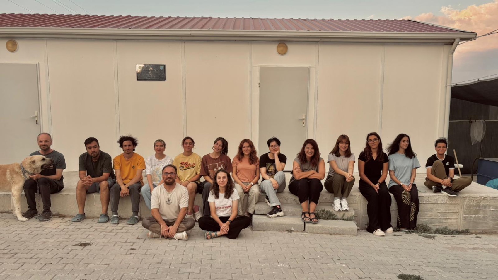
The excavation team sitting on the steps in front of the dig house, smiling; the team dog on the left.
The team at the dig houseSeason memento · excavation archive
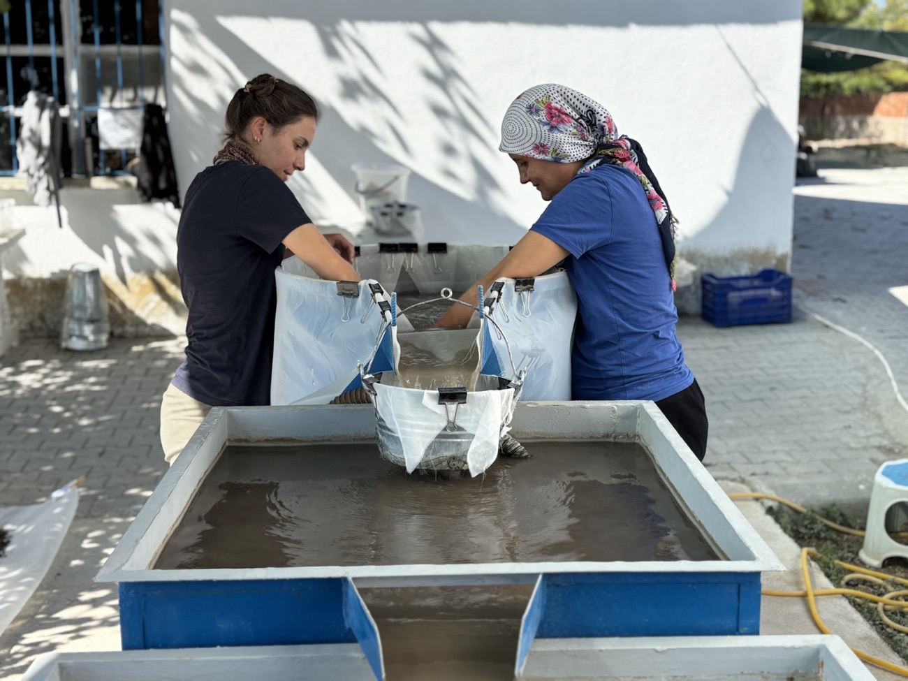
Two team members washing soil samples through a flotation tank.
Flotation: separating seeds from soil
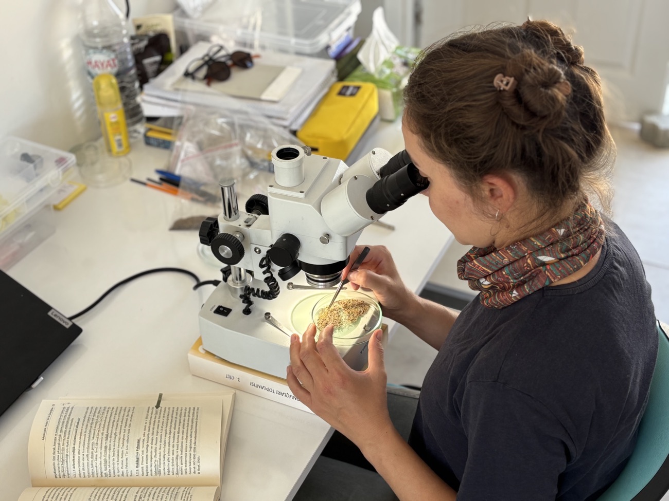
A team member examining an archaeobotanical sample under a microscope.
Examination under the microscope
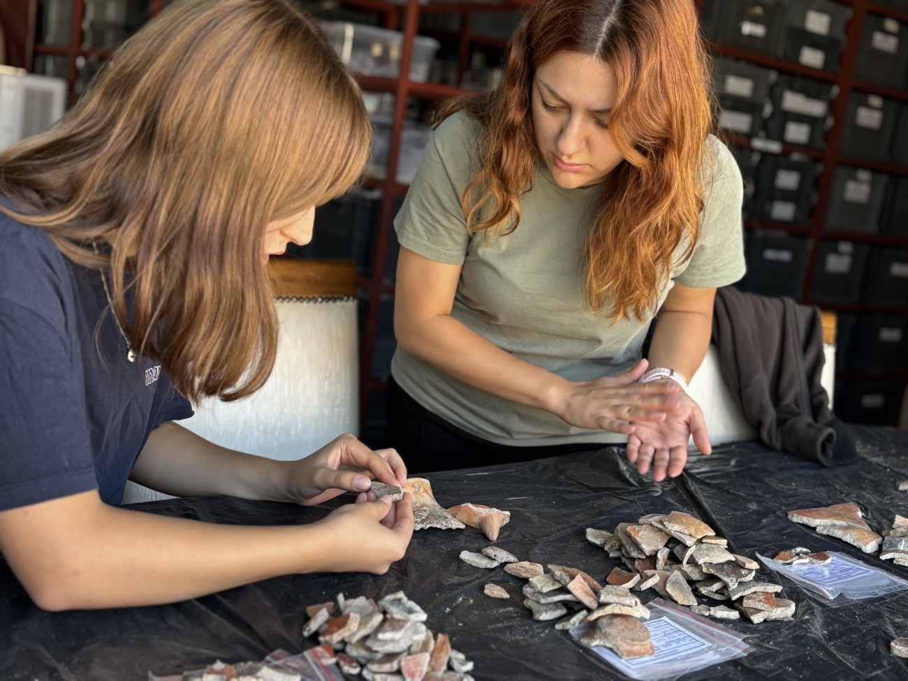
Two team members sorting pottery sherds laid out on a table.
Sorting and recording pottery
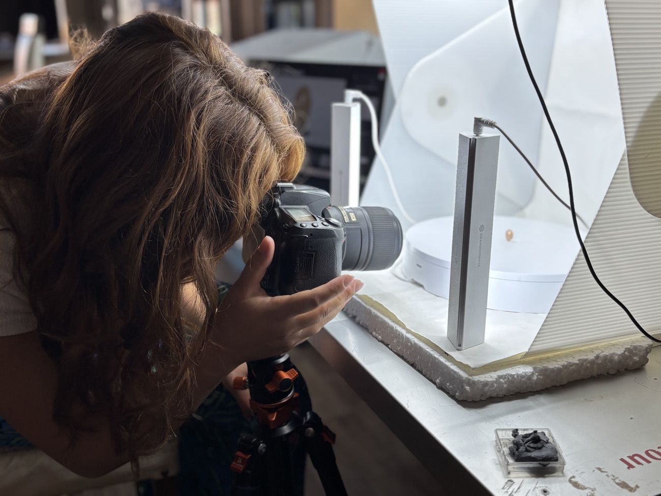
A team member photographing a small find on a tripod inside a light tent.
Photographing the finds

2026 Season · Interdisciplinary research team

Archaeology · Field, Ceramics & Lab

  • Assoc. Prof. Erim Konakçıİzmir Democracy University · ceramics
  • Ayşen Çelebi-TemürEge University · field & data recording
  • İbrahim Kılbaşİzmir Democracy University · lab
  • Nejla Alperfield, lab & recording
  • Okan GezenEge University · field & recording
  • Merve CengizPamukkale University · lab
  • Yeliz TüreoğluPamukkale University · lab
  • Ayşegül YalçınPamukkale University · lab & recording
  • Merve Altınarchaeologist

Bioarchaeology & Zooarchaeology

  • Prof. Başak BozTrakya University · bioarchaeology (anthropology)
  • Prof. Gülçin İlgezdi BertramAhi Evran University · zooarchaeology
  • Nazan Çisem Ergünanthropology

Geology, Geoarchaeology & Palaeogeography

  • Prof. Ertuğ ÖnerEge University · geomorphology & palaeogeography
  • Assoc. Prof. Barış SemizPamukkale University · geology
  • Assoc. Prof. Korhan ErturaçGebze Technical University · geoarchaeology
  • Assoc. Prof. Sena Akçer ÖnMuğla Sıtkı Koçman University
  • Assoc. Prof. Demet BiltekinGebze Technical University · geology
  • Dr. Mustafa KibaroğluUniversity of Tübingen
  • Dr. Zeki Bora ÖnMuğla Sıtkı Koçman University
  • Asst. Prof. Aylin KaradaşEge University
  • Asst. Prof. Rifat İlhanAdıyaman University
  • Res. Asst. Hilal Okur ErturaçGebze Technical University
  • İrem SalmanGebze Technical University
  • Berkay YılmazEge University
  • Elanur KayaEge University

Archaeobotany

  • Prof. Eleni AsoutiUniversity of Liverpool
  • Asst. Prof. Ceren KabukçuUniversity of Liverpool
  • Gülçin UygurEge University

Specialist Analyses & Research

  • Dr. Aysel Arslan Dikerfingerprint analysis on clay finds
  • Prof. Hande Şahinİzmir Democracy University · sociological research

Conservation & Restoration

  • Lecturer Fatma ŞenolEge University · restoration & conservation
  • Lecturer Dr. Çağrı TarhanPamukkale University · conservation & restoration
  • Eda Altuncuconservator
05

Publications

  1. Ekşi Höyük: Archaeological Excavations of 2017–2018
    Dedeoğlu, F. et al. · 41st Excavation Results Symposium (KST), Vol. 2 · Ministry of Culture and Tourism, 2020
  2. Ekşi Höyük 2015–2019: First Results and Observations on the Neolithic Period of the Upper Meander Basin
    Dedeoğlu, F. et al. · Arkeoloji Dergisi, XXIV (2019) · Ege University, Faculty of Letters
  3. Ekşi Höyük: 2016 Excavation Works
    Dedeoğlu, F., Baysal, H. H., Ozan, A., Konakçı, E., Temür, B. · 39th Excavation Results Symposium (KST), Vol. 2, 2018
  4. Ekşi Höyük: 2015 Excavation Works
    Dedeoğlu, F. et al. · 38th Excavation Results Symposium (KST), Vol. 2 · Ministry of Culture and Tourism, 2017
06

News & Events

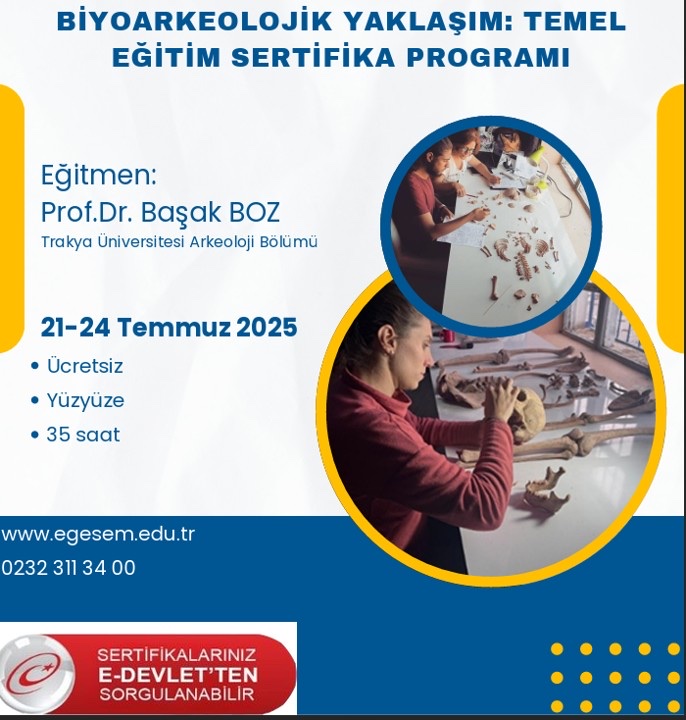
Poster of the Bioarchaeological Approach: Basic Training Certificate Programme; instructor Prof. Dr. Başak Boz, 21–24 July 2025.
Event

Bioarchaeological Approach: Basic Training Certificate Programme

Led by the excavation team's bioarchaeologist Prof. Dr. Başak Boz (Trakya University, Department of Archaeology), this in-person programme focused on the field and laboratory methods for human skeletal remains. The free, 35-hour course was held in cooperation with the Ege University Continuing Education Centre (EGESEM).

2017–2018 excavation report published

The 2017–2018 seasons of Ekşi Höyük appeared among the proceedings of the 41st Excavation Results Symposium.

Neolithic synthesis article released

"First Results and Observations on the Neolithic Period of the Upper Meander Basin" was published in Arkeoloji Dergisi XXIV.

Excavations begin at Ekşi Höyük

Following the surveys, systematic excavation work began at the mound.

07

Contact

AddressEge University, Faculty of Letters, Department of Archaeology
Bornova 35100 · İzmir, Türkiye

Social mediaInstagram

InstitutionalThe Ekşi Höyük excavations are carried out on behalf of Ege University, with the permission of the Turkish Ministry of Culture and Tourism.

Ekşi Höyük excavation logo Ege University logo Republic of Türkiye, Ministry of Culture and Tourism logo